



SmartCity Budapest Transport

คำอธิบายของSmartCity Budapest Transport
SmartCity is a totally free, OFFLINE public transport information application for Budapest. SmartCity offers a vector based map with address search, a public transport route planner and the full schedule of all the public transport lines of Budapest. The full functionality of SmartCity can be used offline.
Key features:
• Modern easy to use user interface based on out 6 years experience on mobile public transport applications.
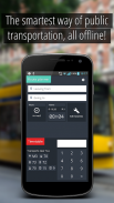
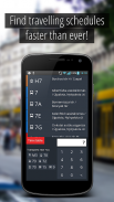
• Offline full timetable of public transport lines including bus, metro, tram, train, suburban train and night lines.
• Timetable data based on the public official GTFS feeds of BKK ( Centre for Budapest Transport)
• Offline map based on OpenStreetMap data.
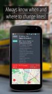
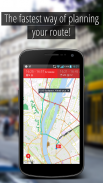
• Visualization of planned route on the map, with vehicle types and connections and visualization of any public transport line with stops
• Ease-of-use offline route planning from current position or from a selected location at any given time with alternative routes
• Offline address database for a quick address search and reverse geocode
• Using current time and position, the routes and timetables of near-by lines can be visualized
• Automated route planning to all favorite destination without network traffic
To use SmartCity Android 2.3 is required, Android 4.0 or better is recommended.
Smartcity เป็นโปรแกรมข้อมูลฟรีครับสำหรับการขนส่งสาธารณะในบูดาเปสต์ Smartcity มีแผนที่เวกเตอร์ตามด้วยการค้นหาที่อยู่, การวางแผนเส้นทางการขนส่งสาธารณะและช่วงเวลาที่เต็มรูปแบบของทุกสายการขนส่งสาธารณะของกรุงบูดาเปสต์ ฟังก์ชันการทำงานเต็มรูปแบบของ Smartcity สามารถใช้แบบออฟไลน์
คุณสมบัติที่สำคัญ:
•โมเดิร์นที่ง่ายต่อการใช้อินเตอร์เฟซผู้ใช้บนพื้นฐานจากประสบการณ์ 6 ปีในการใช้งานโทรศัพท์มือถือระบบขนส่งสาธารณะ
•ออฟไลน์ตารางเต็มรูปแบบของสายการขนส่งสาธารณะรวมทั้งรถบัสและรถไฟใต้ดินรถราง, รถไฟ, รถไฟชานเมืองและเส้นคืน
•ข้อมูลตารางเวลาขึ้นอยู่กับประชาชนฟีด GTFS อย่างเป็นทางการของกทม. (ศูนย์บูดาเปสต์ขนส่ง)
•แผนที่แบบออฟไลน์บนพื้นฐานของข้อมูล OpenStreetMap
•การแสดงของวางแผนเส้นทางบนแผนที่กับประเภทของยานพาหนะและการเชื่อมต่อและการสร้างภาพของสายการขนส่งใด ๆ ของประชาชนที่มีการหยุด
•ง่ายต่อการใช้งานแบบออฟไลน์วางแผนเส้นทางจากตำแหน่งปัจจุบันหรือจากสถานที่ที่เลือกในเวลาใดก็ตามที่มีเส้นทางอื่น
•ฐานข้อมูลที่อยู่ออฟไลน์สำหรับการค้นหาที่อยู่อย่างรวดเร็วและ geocode ย้อนกลับ
•การใช้เวลาปัจจุบันและตำแหน่งเส้นทางและตารางเวลาของใกล้โดยสายสามารถมองเห็น
•อัตโนมัติวางแผนเส้นทางไปยังปลายทางที่ชื่นชอบโดยไม่ต้องมีเครือข่ายการจราจร
หากต้องการใช้ Smartcity Android 2.3 จะต้อง Android 4.0 หรือดีกว่าขอแนะนำ


